


Scaled Spatial Development
Started in 2020, XYCarto is focused on delivering spatial development solutions and analysis for projects large and small across the spatial spectrum.
+
Remote Sensing Data
+
Web Mapping Development
+
Vector and Raster
Open Source
We work with a vast array of open technologies ensuring scripted, automated, and programmatic solutions for geospatial data. Our solutions are designed for cloud environments to work at local, national, and worldwide scales.

Cartography
Award winning cartography blending the highest quality data and science into impactful visualizations.

Analysis
We always strive to find the best possible solution to complex spatial problems impacting our environment, climate, infrastructure implementing the latest tech from the FOSS4G community.
Stories
Latest in the Blog
Our goal is to grow and support our community offering basic tutorials for scripted GIS processes.
-

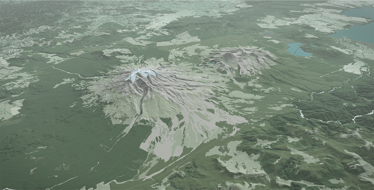
Cartographic Aotearoa
I try hard to keep this blog about basic open source processing in GIS. I don’t spend much time talking about my cartographic work, since I like put it up in the gallery and try to let it speak for itself. Further, 90% of my cartographic products involve processing data before it ever gets to
-
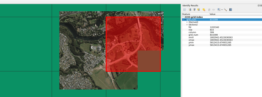
Projection Grid
There are times when I need a regular grid for an entire projection extent. Meaning, for the extent of an entire projection, I need to create a regular grid of uniform tiles across the projection. In past projects, these grids have been very helpful for data alignment and clipping data into uniform shapes and sizes.
-

GRASS GIS, Docker, Makefile
Small example of using Docker and Makefile to implement GRASS GIS. This blog is written to be complimentary to the Github repository found here. Included in this post is a more verbose explanation of what is happening in the Github repository. Users can explore the scripts to see the underlying bits that make it each
