Visualization

>Antarctica_wall_map
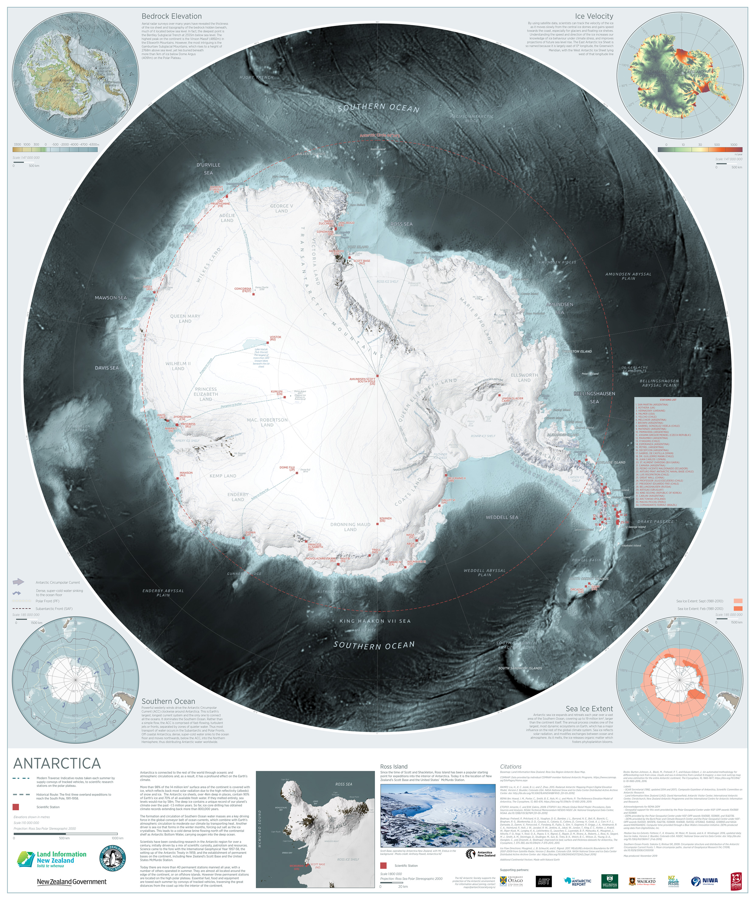
Antarctica map completed during my time with Land Information New Zealand (LINZ). I do not have rights for the distribution of high resolution digital prints or copies. Please contact Land Information New Zealand (LINZ) or NZ Antarctic Society for information obtaining high resolution images. “Source: This image is licensed by LINZ for re-use under the Creative Commons Attribution 4.0 International license.”
zealandia
gravity_final

External project visualizing recent NZ gravitational survey.“Source: Land Information New Zealand (LINZ) and licensed by LINZ for re-use under the Creative Commons Attribution 4.0 International license.”
Kaikoura_forWeb

Project highlights changes in bathymetry in Kaikoura region following November 2016 Earthquake. “Source: Land Information New Zealand (LINZ) and licensed by LINZ for re-use under the Creative Commons Attribution 4.0 International license.”
te_puke_bop_map

Bay of Plenty Region Council (BOPRC) LiDAR Data Visualization.
lidar_poster_forWeb

Promotional material describing how LiDAR improves elevation data. “Source: Land Information New Zealand (LINZ) and licensed by LINZ for re-use under the Creative Commons Attribution 4.0 International license.”
crownareas_forWeb

Promotional material comparing landholdings between two NZ governmental organizations. “Source: Land Information New Zealand (LINZ) and licensed by LINZ for re-use under the Creative Commons Attribution 4.0 International license.”