Please email me direct for prices and quotes.
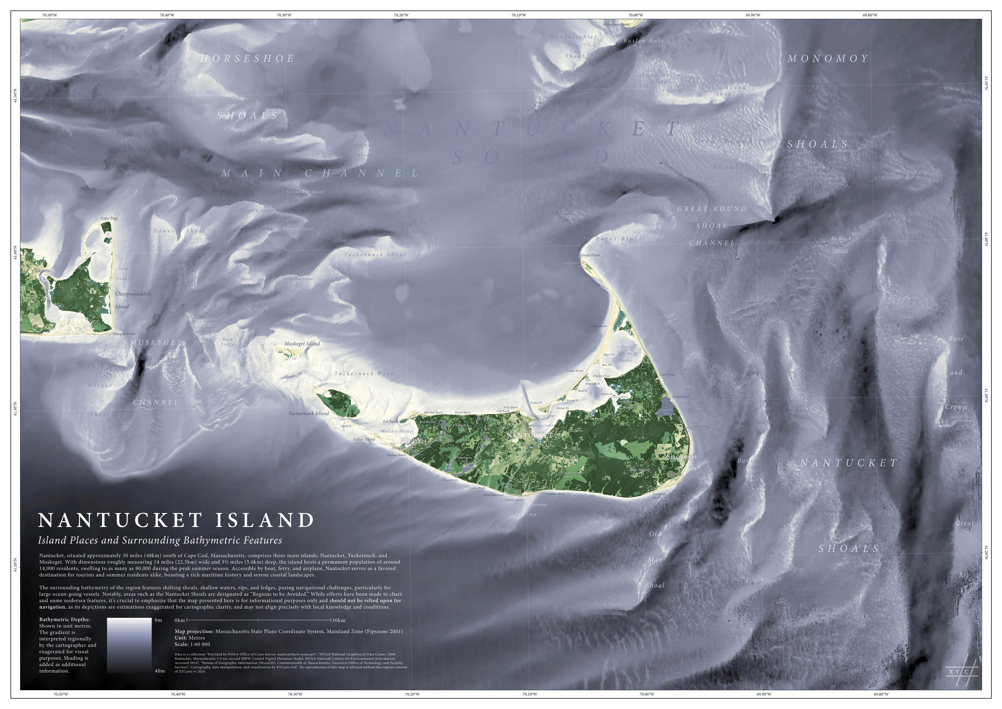
Nantucket Island: Cartographic depiction of Nantucket Island with surrounding bathymetry. Place names and bathymetric features are labeled based on information gathered from nautical charts and public data sources from the state of Massachusetts. Map print is offered in A0, A1, or A2 sizes. Cartography completed in 2024.

Whaingaroa Harbour: Cartographic depiction of Whaingaroa Harbour (Raglan), Aotearoa (New Zealand). Harbour depths originally from the Modeling House, with interpolations completed by XYCarto in 2020. Map print is offered in A0, A1, or A2 sizes. Cartography completed in 2020. Originally offered for sale through Zinnia, Raglan, New Zealand.

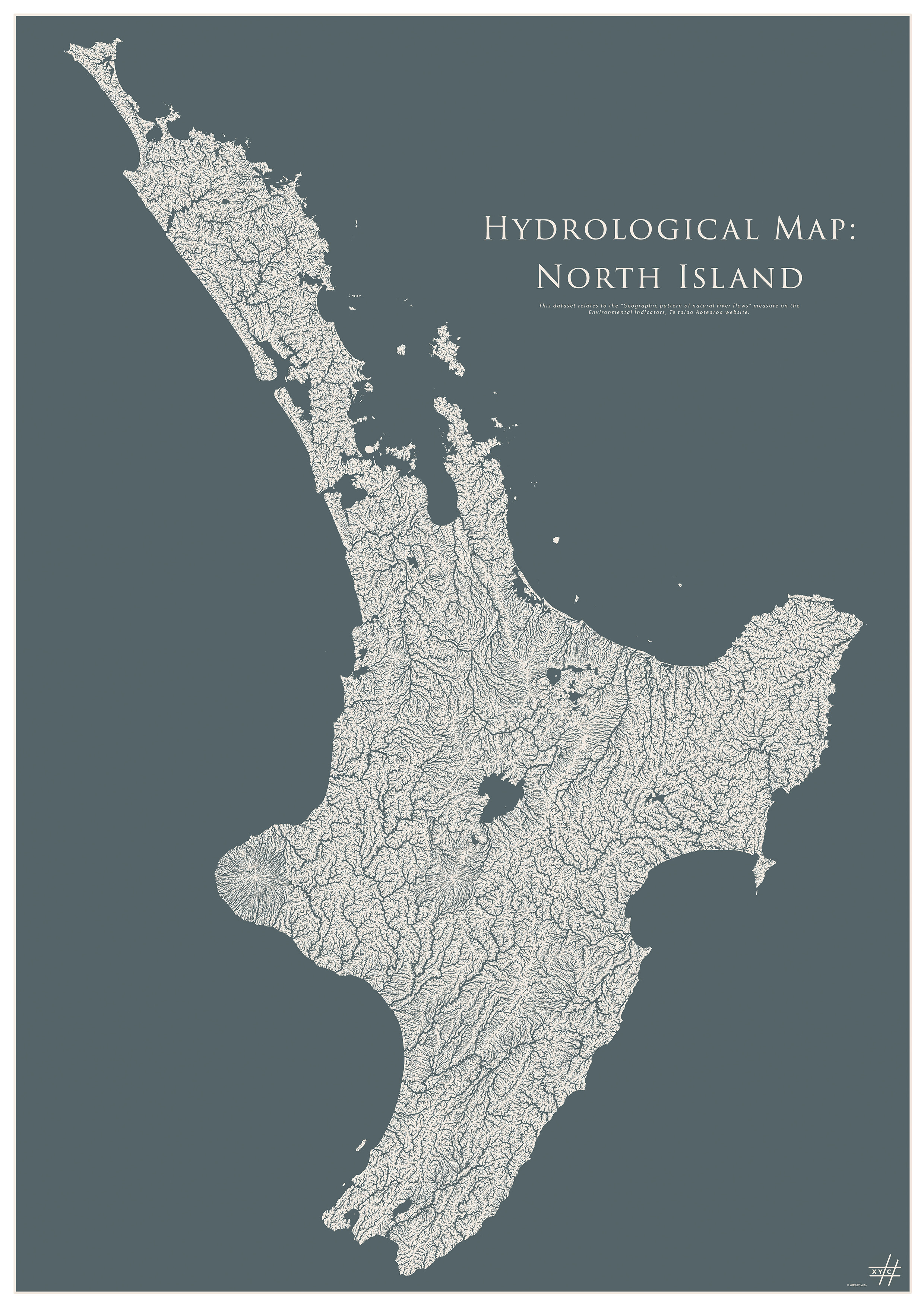
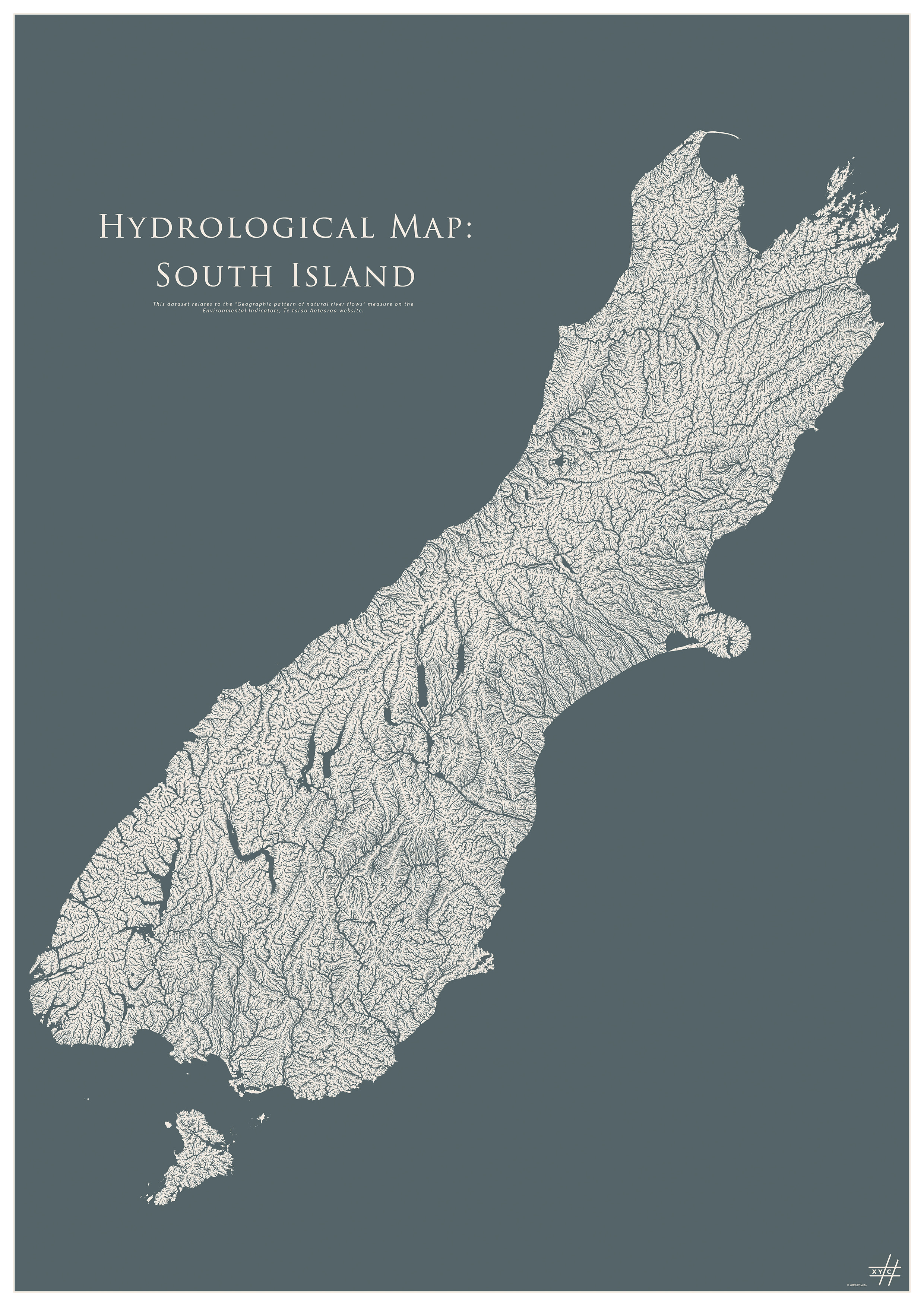
Aotearoa New Zealand: Topographic inspired map of New Zealand. Selected for entry into the Atlas of Design VII. Map is a depiction of New Zealand and surrounding bathymetry. Place names and bathymetric features are taken from New Zealand Geographic Board (NZGB) and map is developed using New Zealand geospatial public data from Land Information Zealand (LINZ) and National Institute of Water and Atmospheric Research (NIWA). Prints available in A0 and A1. Cartography originally completed in 2019 with yearly updates since release. Listen to an interview on Radio New Zealand (RNZ) about the map here.
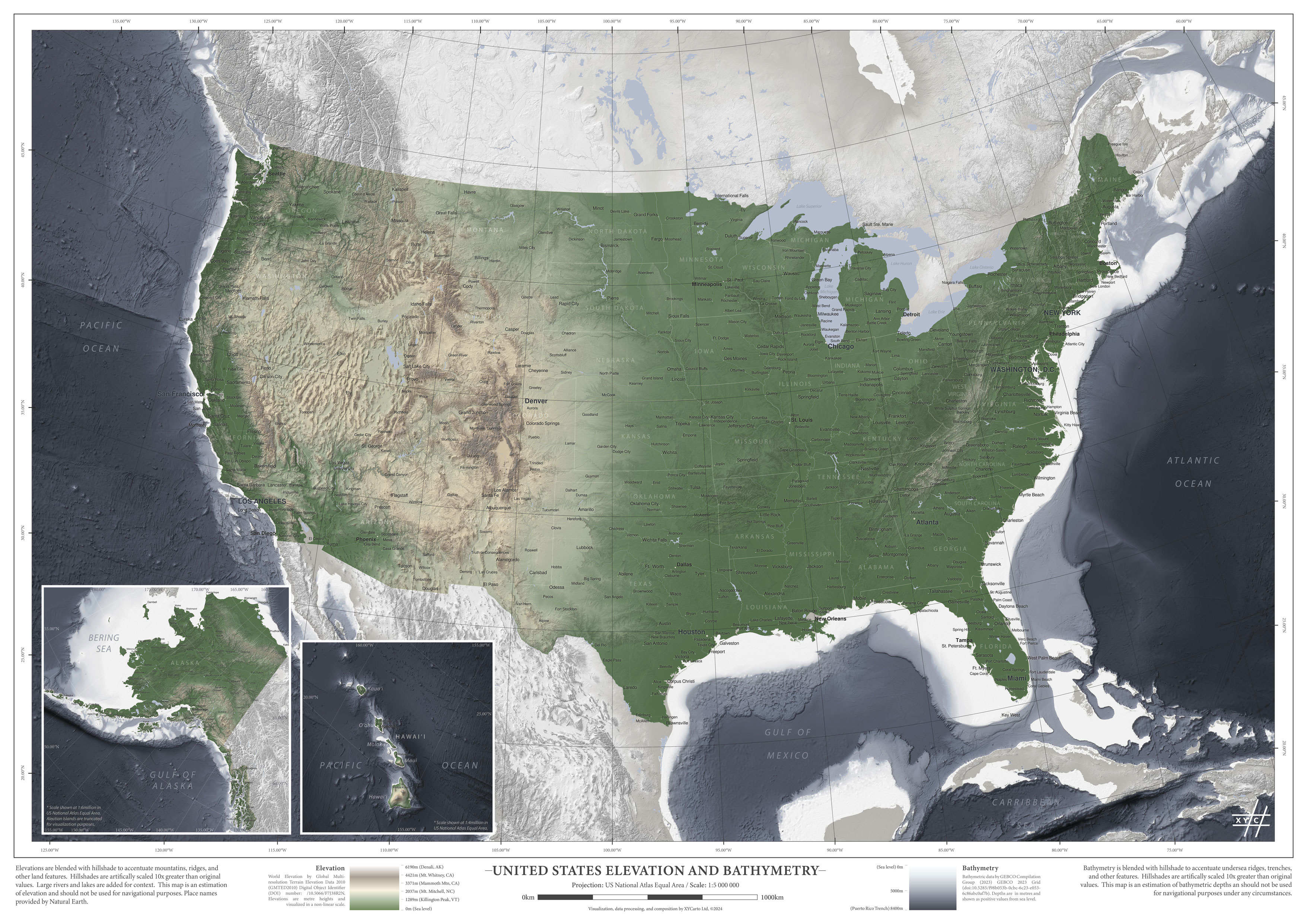
United States Elevation: Cartographic depiction of elevation and surrounding bathymetry of the United States with states and major cities shown. Elevation and bathymetric heights are exaggerated to ten times their original values to improve visual cartography. This map is an experimentation for a world map series. Prints available in A0 and A1.
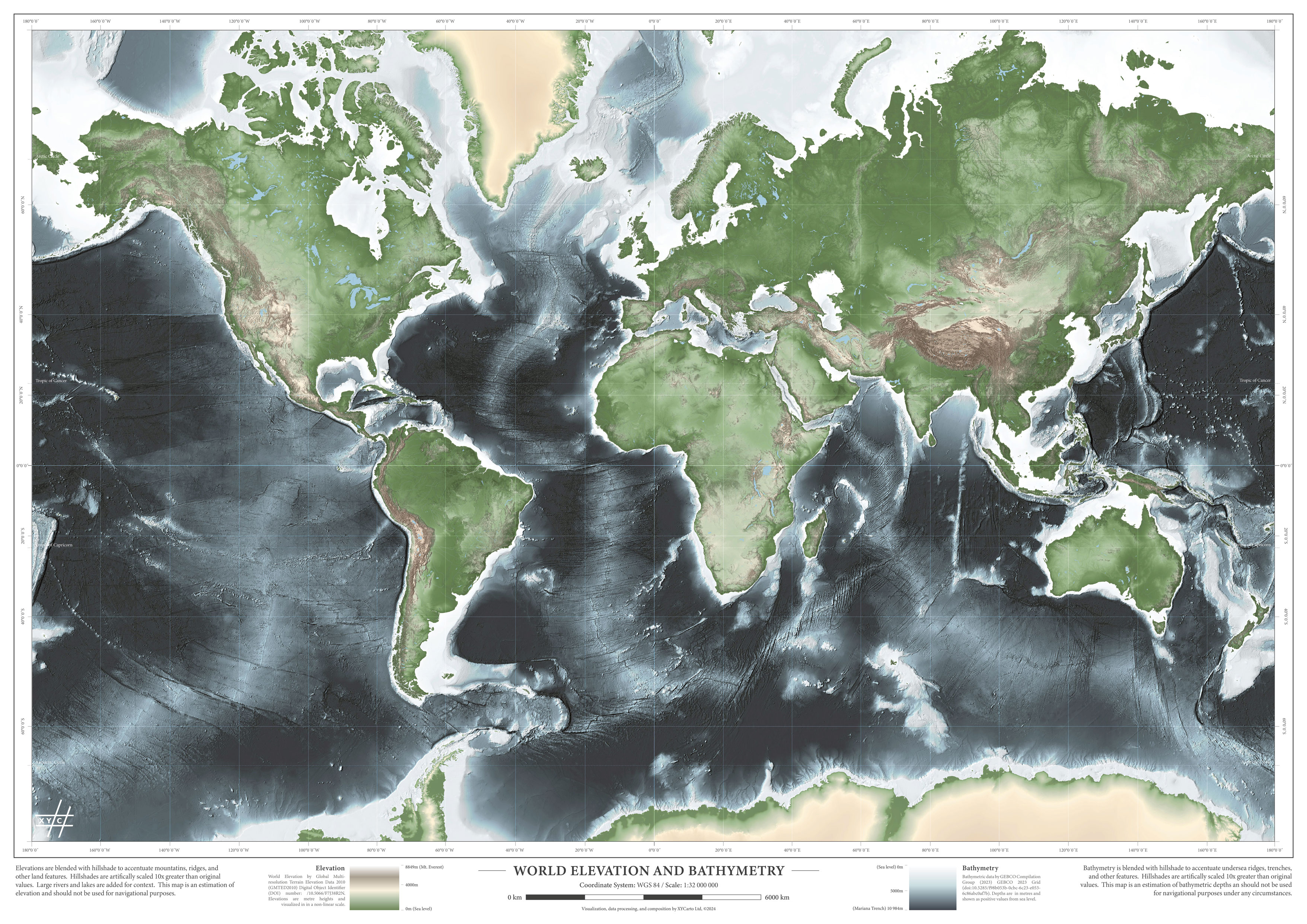
World Map Elevation: Basic map depicting world elevations and bathymetry. Map is intentionally shown without labels allowing the user to explore the world without borders and focus on features instead. This map is a precursor to an interactive world elevation map scheduled for release online in mid-2024. Prints are available in A0, A1, and A2. Cartography completed 2024.
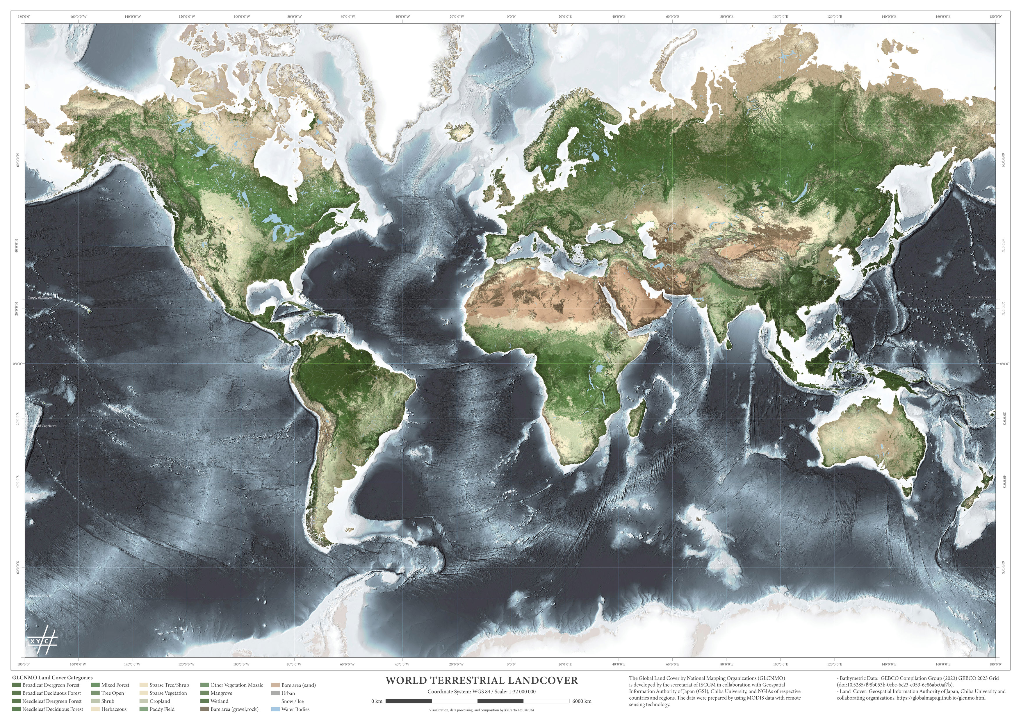
World Map Land Cover: Basic map depicting world land cover. Map is intentionally shown without labels allowing the user to explore the world without borders and focus on features instead. Relief is blended with the map to add context. Prints are available in A0, A1, and A2. Cartography completed 2024.
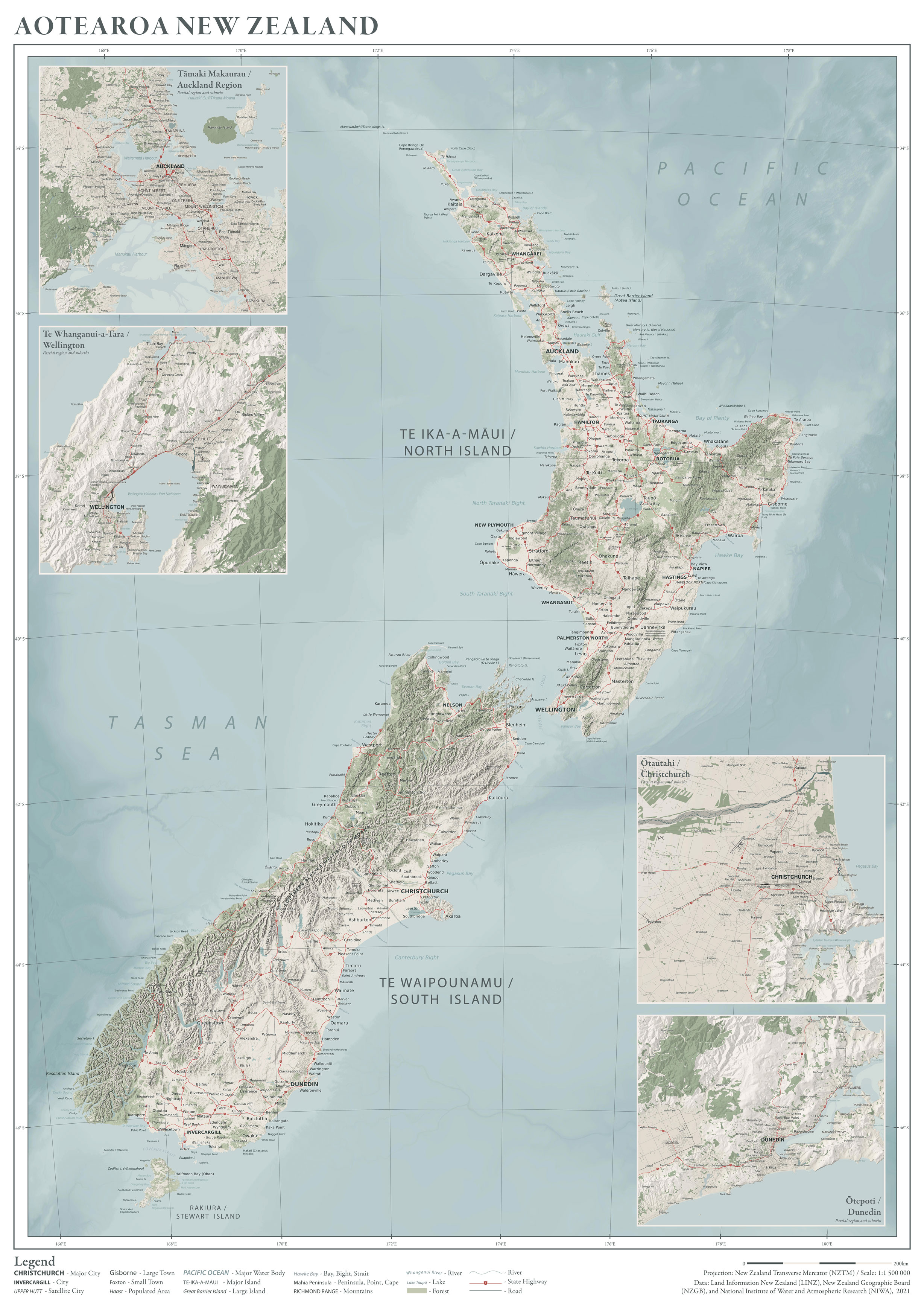
Aotearoa New Zealand Topographic Map: Based on the work from the original Aotearoa New Zealand map, this map is a closer rendering of a traditional topographic map of New Zealand. Cities and towns are shown, along with state highways and various land features. This map still strays from a full on topographic map and the cartography is a play on a more old style map. It is likely this map will be updated several times in the coming years to improve legend information and pull more land data in. Prints are available in A0 and A1.
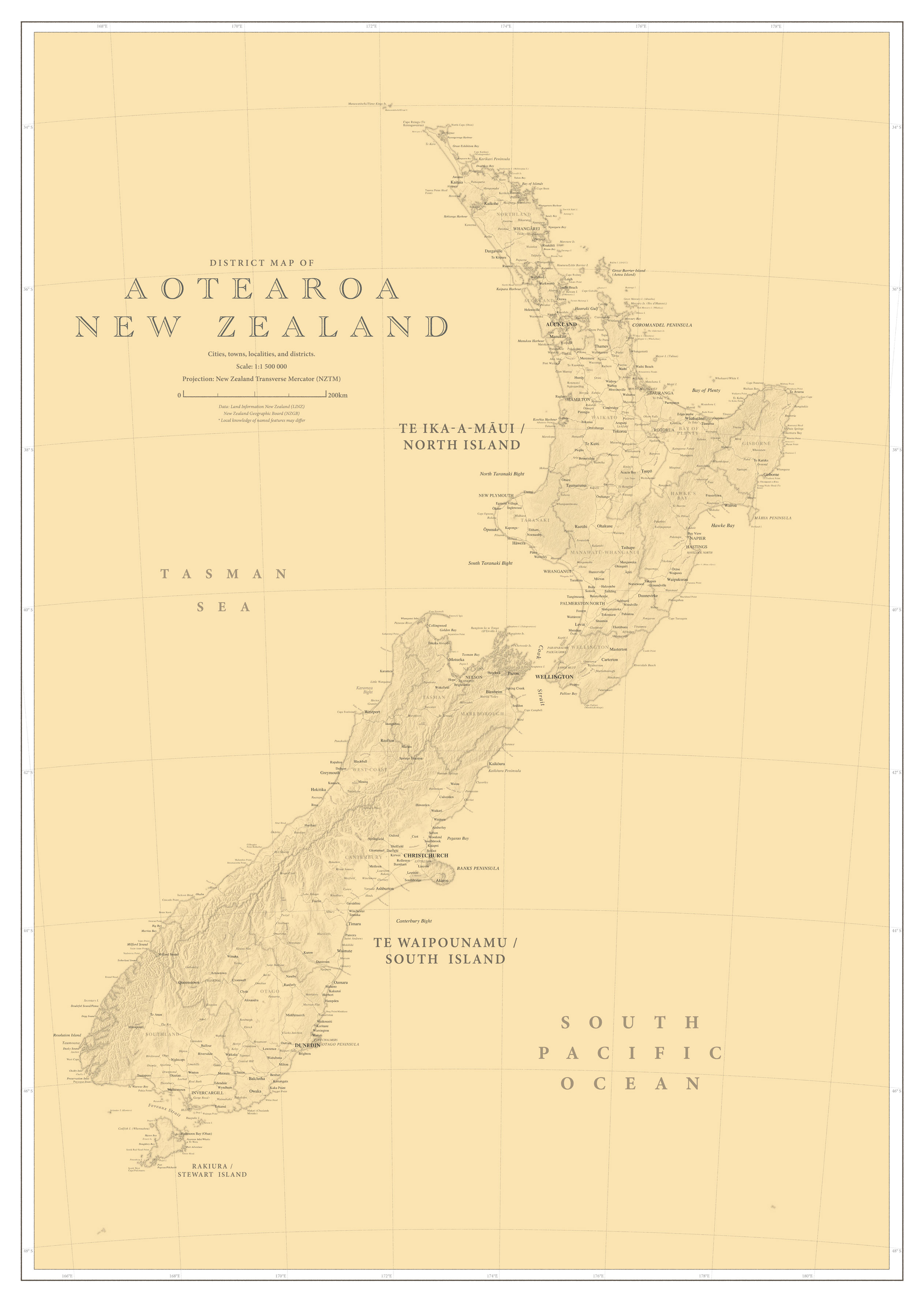
Aotearoa New Zealand Antique Style District Map: Derivation of original Aotearoa New Zealand map, this is a play on older map cartography. Map retains modern information, but uses older font styles and fewer details. New Zealand land districts are added. Originally, not intended for sale, but instead an experimentation towards older styles. Prints can be available in A0 and A1. Cartography completed in 2024.

Matakitakiakupe: Early commissioned work created for the depiction of the south coast North Island New Zealand. Blend of high resolution 1m Digital Elevation and Surface models (DEM/DSM) with high resolution aerial imagery. Some information regarding seafloor features derived from New Zealand Hydrographic Office charts. Cartography completed in 2016.